Weather
Multi-day Christmas storm starts warm in Park City, with colder air and the best snowfall potential of the season arriving late week
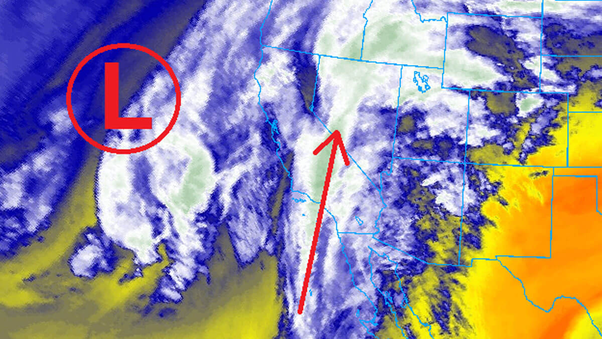
Water vapor imagery shows a powerful atmospheric river streaming in from the south, as a strong low-pressure center remains off the coast of California Photo: California // College of DuPage NEXRAD
Things may get a little worse before they get better, with rain pushing up near 10,000 feet on Christmas Eve. Keep those snow dances going though — colder air moves in Friday into Saturday, with a legitimate shot at 8–16 inches across the Wasatch Range.
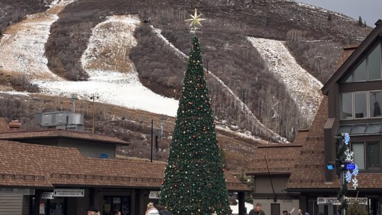
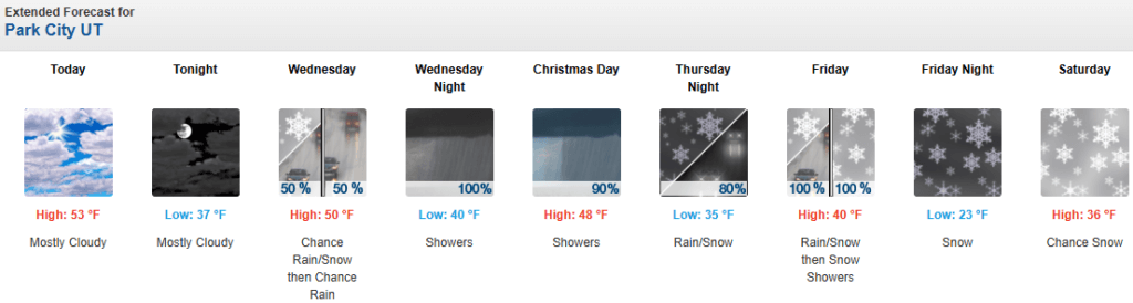
PARK CITY, Utah – Utah’s rough start to winter continues as a multi-day storm cycle moves into the region, beginning Wednesday afternoon and lasting through Saturday. For Park City skiers and riders, the first half of this system brings exactly what the low snowpack does not need: record warmth, strong winds, and rain. The second half offers something far more important — colder air, lowering snow levels, and the best chance yet this season for meaningful snowfall.
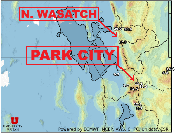
Forecast Snow Totals (Thursday – Saturday)
- Cottonwood Canyons: 9-18″
- PC Base/Town: 2-5″ (Friday into Saturday)
- Deer Valley/PCMR: 7-12″
- N. Wasatch (Powder/Snowbasin): 10-20″
Christmas Eve and Christmas Day Forecast: Warm, Windy, and Wet
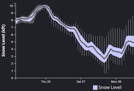
Strong southerly winds will begin ripping on Wednesday as a strong atmospheric river approaches from almost due south, which is different than what we’ve seen with similar previous systems this season. Thus, temperatures will remain elevated well above normal for this time of year in Park City, with daytime highs near 50 degrees through Thursday. Snow levels will increase during this initial period to near 10,000 feet on Wednesday, before dropping closer to 8,000 feet throughout the day on Christmas.
Rain showers will develop Wednesday afternoon in the mountains before becoming more widespread overnight and into Thursday. The mountains should pick up a couple inches during this initial warm and very windy period, as winds eventually shift more southwesterly rather than almost straight out of the south. There remains a chance for some embedded thunderstorms as well during this time.
Brief Lull, Then a Critical Change Late Christmas Night
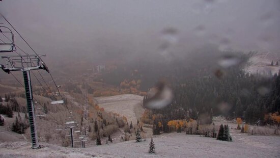
After a lull in activity Thursday afternoon and into the evening, light showers will continue before the next much colder phase of the storm begins. As snow levels gradually drop throughout the day Thursday, it remains possible that very late in the night (think midnight) on Christmas day, rain will begin transitioning to snow in town in Park City, as the snowline finally approaches the 7000-foot level. The Uinta mountains are expected to receive 6-12” of snow during this first wave due to their higher elevation, and east-west orientation.
Part Two: Friday Through Saturday Brings the Shift Skiers Need
The upper-level low-pressure center begins to track across Utah on Friday, dropping snow levels from 7000 feet early in the morning down to nearly 4500 feet by Saturday. This colder, stronger part of the storm will bring decent accumulations of 5-10” in the mountains throughout most of the day on Friday, as winds begin to shift westerly with the cold front passage late in the evening. The Northern Wasatch areas, including Powder Mountain and Snowbasin, may pick up the highest accumulations, as they remain in the coldest air for the longest period.
Snowfall will continue overnight Friday before winds briefly turn towards a more northwesterly direction Saturday morning, bringing drier air with it, finally signaling the end of the storm cycle. Light snow showers may continue into Saturday afternoon, with light accumulations expected. There remains a chance that the lower elevation valleys, including Salt Lake, may see some measurable snow overnight Friday into Saturday morning. This would be the first snowfall of the season for Salt Lake City if this occurs, with better chances for snow accumulation on the benches.
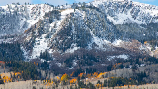
Snowpack Update
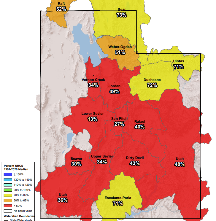
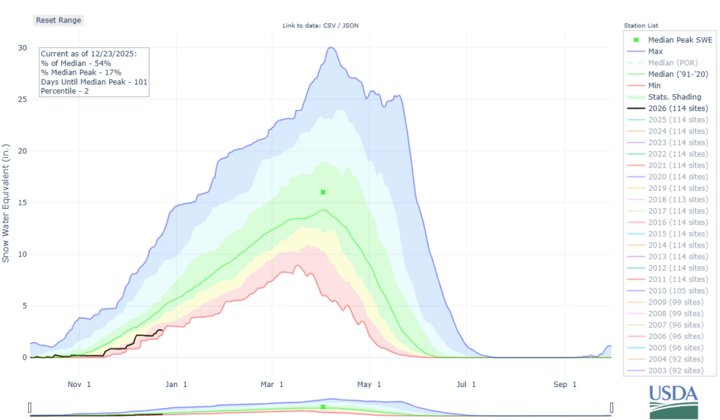
With record precipitation recorded in October, things looked optimistic here in Utah for the beginning of the upcoming winter ski season. However, things took a turn for the worst as November broke the record for the warmest November ever observed, in addition to well below normal precipitation. With a little more than a week left in December, it is also currently approaching record breaking warm temperatures for the month.
Statewide snowpack numbers show many drainage basins less than 50% of normal for this time of year. It’s possible we will reach record-low statewide snowpack in the next day or two as warm temperatures, strong winds and rain arrive.
Park City snow conditions: What skiers & riders can expect during Christmas week
Deer Valley World Cup events moved to East Coast amid warm weather, limited snow
By: Adam Lenkowski

438 Castle Valley Drive
Castle Valley, UT 84532
2349 S Lava Vista Drive, Lot 32
Santa Clara, UT 84765
3267 W Deer Hollow Road, Unit 2305
Park City, UT 84060
80 West 300 North
Salt Lake City, UT 84103Talk of the Town


Park City Jobs

Junior Interior Designer, Abigail Hill
3 days ago Contractor

Dental Assistant, Rise Dental Wellness
4 days ago Full time

Sales & Marketing Coordinator – B2B Publishing, Power Trade Media
6 days ago Full time $40,000 - $45,000 yearly

Computer / Website Assistant, Summit Support
10 days ago Part time $20.00 - $30.00 hourly

Garden Steward and Educator, Summit Community Gardens and EATS
10 days ago Seasonal