Snow
Dry spell over in Wasatch mountains after Sunday snow, similar storm on the way Tuesday
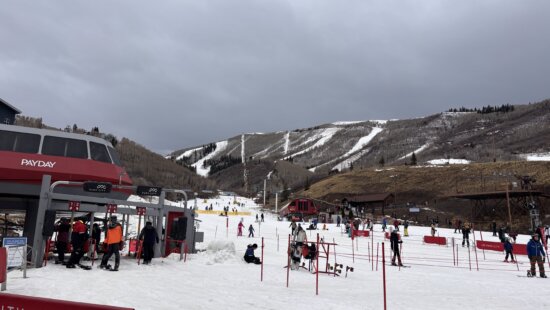
Clear skies on December 1, 2025, show a fresh coat of snow that arrived after a record-dry November. Photo: Park City Mountain Resort
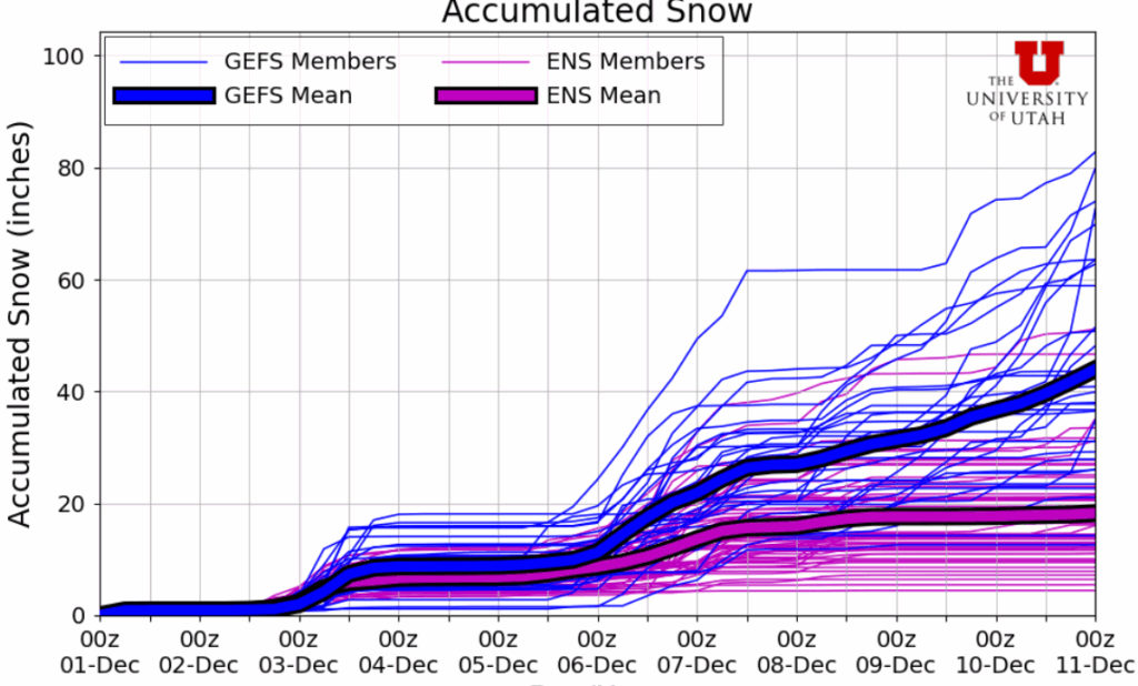
4 - 9” of snow expected for the Wasatch Tuesday into Wednesday morning
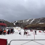
PARK CITY, Utah – As we now enter December, it’s beginning to look a little more like winter after the storm on Sunday dropped up to 10 inches of snow across the Wasatch, with 5-6 inches in the Park City area mountains. The next small system is already on our our doorstep, with a similar setup and snowfall amounts to the last storm, with totals forecast in the 4 to 9 inch range for the Wasatch.
Temperatures will remain chilly all week, with some locations briefly dipped into the single-digits Monday morning as clearing skies overnight allowed cold air to pool in the valleys. It will feel like winter this week with daytime highs near freezing and lows dipping into the teens overnight.
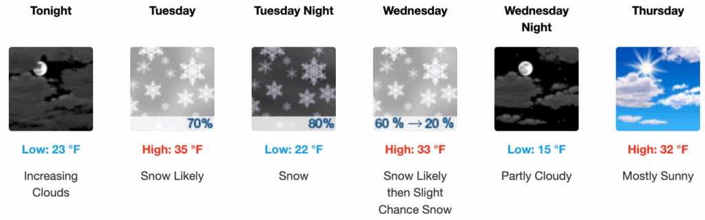
Light snowfall looks to begin in the higher terrain starting as early as Tuesday morning, but the main cold front and heaviest snowfall kicks in overnight Tuesday into early Wednesday morning. Upper level winds remain out of the west/northwest, followed by a sharp shift to northerly as the front passes, which would limit any potential lake-effect for the central Wasatch. Most of the snowfall looks to taper off by midday Wednesday.
Forecast Snow Totals Tuesday – Wednesday
- Cottonwood Canyons: 4 – 9”
- PC Base/Town: 1 – 3”
- Deer Valley/PCMR: 3 – 6”
- N. Wasatch (Powder/Snowbasin): 3 – 7”
Snowpack Update
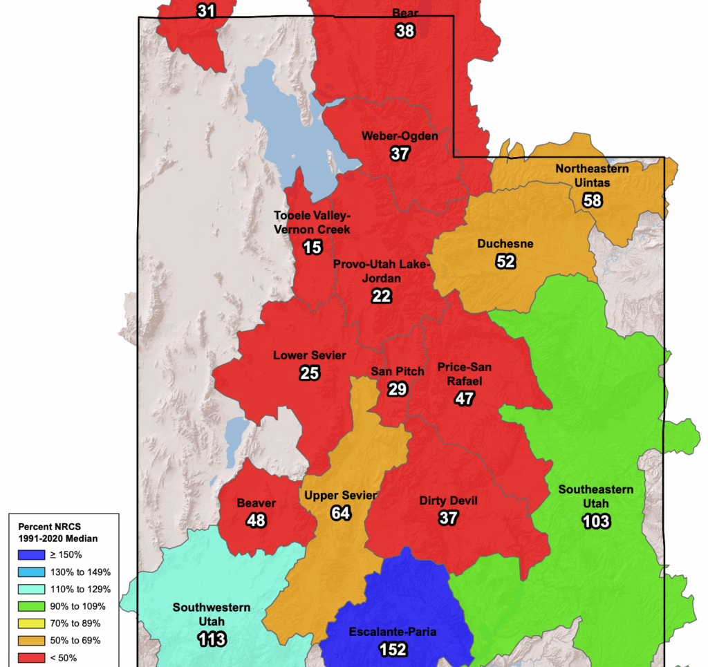
Even with the recent snowfall on Sunday, snowpack conditions remain dismal across much of northern Utah. The Snowbird SNOTEL monitoring station is reporting just 26% of normal for this time of year for snow water equivalent. Percent of normal type statistics can be a bit deceiving this early in the season, and one large storm cycle can quickly turn the tide here in the Wasatch.
Extended Outlook
Looking further ahead, the next potential storm cycle begins on Friday and extends into the weekend. However, Utah remains on the southernmost end of the moisture of an atmospheric river type event, followed by an extended period of northwesterly flow. If the track shifts just a bit south, as one of the forecast models indicates, we may end up with some decent snow totals.
By: Adam Lenkowski

325 White Pine Canyon Road
Park City, UT 84060
2349 S Lava Vista Drive, Lot 32
Santa Clara, UT 84765
3267 W Deer Hollow Road, Unit 2305
Park City, UT 84060
1511 S Valley View Circle
Springville, UT 84663
438 Castle Valley Drive
Castle Valley, UT 84532
80 West 300 North
Salt Lake City, UT 84103Talk of the Town


Park City Jobs

Hiring Barista Assistants and Baristas, Silver King Coffee
2 days ago Part time $17.00 - $30.00 hourly
General Maintenance Technician, Moose Management Vacation Rentals
6 days ago Full time

Office Coordinator, Park City Community Foundation
9 days ago Full time $50,000 - $55,000 yearly

Summit Land Conservancy Programs Specialist, Summit Land Conservancy
9 days ago Full time
Vice President of Finance, Park City Community Foundation
9 days ago Full time $115,000 - $130,000 yearly