Weather
Wasatch weekend weather faces triple threat: thunder, rain, and up to 6” of snow

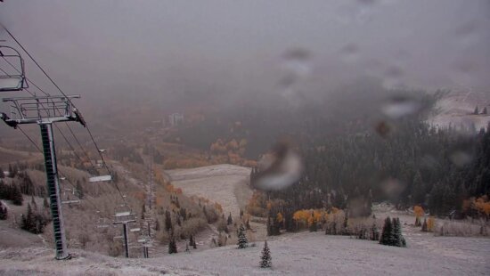
Snowliage on Guardsman's Pass Oct. 7, 2025 Photo: TownLift // Randi Sidman-Moore
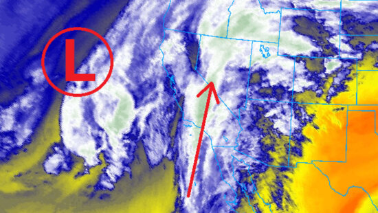
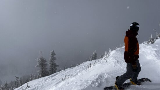
A surge of moisture from decaying hurricane Priscilla has begun to spread into Utah overnight, eventually interacting with a strong cold front Saturday evening bringing 3 – 6” of snow to the Wasatch by Sunday.
PARK CITY, Utah – With one early season snowstorm in the Wasatch already under our belt from last weekend, a second is now on the way Saturday night. Although the weakening Hurricane Priscilla (now a tropical storm) is a long way away situated off the southern Baja Mexico coast, significant moisture is getting transported into the southwest United States and Utah.
Showers moved into northern Utah overnight, and scattered showers and thunderstorms will persist for most of Friday associated with this influx of moisture. Updated forecast model guidance is keeping more of the moisture to our south and east than previously advertised, so there will be breaks in the action Friday and likely on Saturday late morning through early afternoon. Temperatures will be mild with highs in the 60s as we remain in the moist southerly flow through midday Saturday.

The approaching cold front originating from a totally separate low pressure-system off the west coast is forecast to arrive between 5 pm – 7 pm Saturday evening, bringing with it a line of thunderstorms developing ahead of it and plummeting temperatures. The NOAA Storm Prediction Center has also indicated a marginal risk for severe weather and strong thunderstorms on Saturday.
Snow levels will drop quickly with this cold frontal passage, possibly down to nearly 6000 ft overnight. However, a significant amount of the precipitation will fall as rain, which will aid in melting the minimal high elevation snowpack that currently exists on some slopes. Forecast snow totals are 3 – 6” for most of the Wasatch Mountains as this quick moving cold front pushes through overnight. However, drier air quickly moves in on Sunday which will limit potential higher snowfall accumulations, along with the warm temperatures ahead of the cold front.

By: Adam Lenkowski

3267 W Deer Hollow Road, Unit 2305
Park City, UT 84060
2349 S Lava Vista Drive, Lot 32
Santa Clara, UT 84765
80 West 300 North
Salt Lake City, UT 84103
438 Castle Valley Drive
Castle Valley, UT 84532Talk of the Town


Park City Jobs

Sales & Marketing Coordinator – B2B Publishing, Power Trade Media
1 day ago Full time $40,000 - $45,000 yearly

Computer / Website Assistant, Summit Support
5 days ago Part time $20.00 - $30.00 hourly

Garden Steward and Educator, Summit Community Gardens and EATS
6 days ago Seasonal
PROGRAM AND EVENT COORDINATOR, PC READS
6 days ago Part time $25.00 hourly
Development Manager, Blue Sky Utah
7 days ago Part time $28.00 - $32.00 hourly