Weather
October deluge continues with more rain and 5-10” of snow starting Wednesday
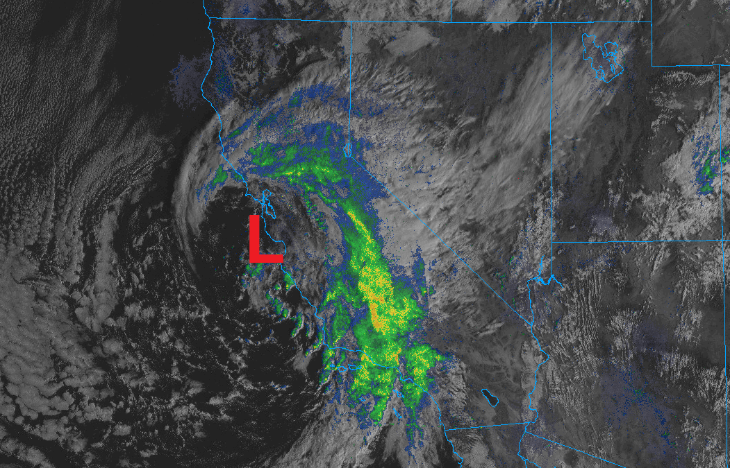
A radar/satellite image of the large low-pressure system currently centered over California Photo: College of DuPage NEXRAD
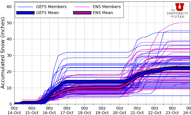
5-10” of snow is expected for the Wasatch Mountains tonight through Thursday, as yet another strong pacific storm impacts the area
PARK CITY, Utah – It’s been an incredibly active start to October for Utah, and another potent storm is right on our doorstep. Several rounds of thunderstorms streamed through Utah last night, out ahead of the main low-pressure system currently situated in California.
Those storms broke the all-time record for precipitation for the month of October at the NWS Salt Lake City International Airport weather station with 4.16”, stated Matthew Johnson of KSL via a social media post. This ousted the old record of 3.91” set in 1981, with half of the month still left to go.
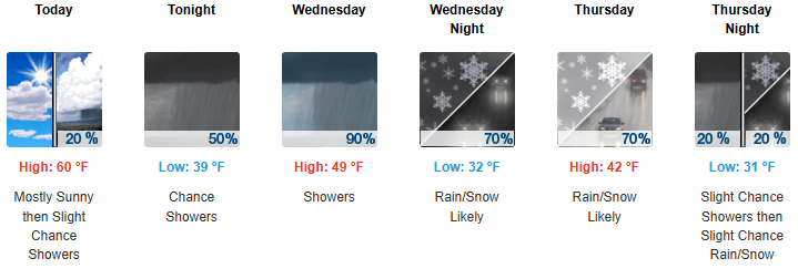
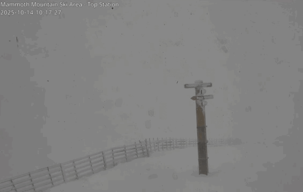
With a break in activity today, scattered showers in the higher terrain are possible this evening as the closed-low begins to track east toward Utah. Snow levels will begin high near 9,500 feet, decreasing throughout the day on Wednesday down to almost 6,500 feet as the cold front slowly pushes across Utah. The low is currently impacting the southern Sierra range including Mammoth resort, where they received 6-10” already and are forecast to get 3-7” more today before the system heads toward Utah.
Forecast Snow Totals through Thursday
- Cottonwood Canyons: 5 – 10″
- PC Base: 1 – 2″
- Deer Valley/PCMR: 2 – 5″
- N. Wasatch (Powder/Snowbasin): 5 – 9″
There should be a lull in activity Wednesday night into Thursday morning. The low then tracks further north and winds finally begin to shift more westerly, with a brief period of west-northwest winds. If this second phase of the storm system pans out, this could lead to higher accumulations in these favored areas, including upper Little Cottonwood and the northern Wasatch resorts (Powder Mountain/Snowbasin).
The strong, but brief cold front that rolled through last Saturday with thunder, lightning, and a quick burst of snow fell on mostly bare slopes where the prior snowfall had melted, except maybe at the very highest elevations. About 3” was recorded at Alta Saturday with the frontal passage, with slightly higher amounts observed in the northern Wasatch, with roughly 4-5”. The forecast models are pointing toward the overall pattern remaining fairly active, with the next storm system set to possibly impact Utah early next week.
By: Adam Lenkowski

438 Castle Valley Drive
Castle Valley, UT 84532
2349 S Lava Vista Drive, Lot 32
Santa Clara, UT 84765
3267 W Deer Hollow Road, Unit 2305
Park City, UT 84060
80 West 300 North
Salt Lake City, UT 84103Talk of the Town


Park City Jobs

Sales & Marketing Coordinator – B2B Publishing, Power Trade Media
1 day ago Full time $40,000 - $45,000 yearly

Computer / Website Assistant, Summit Support
5 days ago Part time $20.00 - $30.00 hourly

Garden Steward and Educator, Summit Community Gardens and EATS
6 days ago Seasonal
PROGRAM AND EVENT COORDINATOR, PC READS
6 days ago Part time $25.00 hourly
Development Manager, Blue Sky Utah
7 days ago Part time $28.00 - $32.00 hourly