Snow
Deer Valley’s new trail map shows this season’s slice of massive expansion
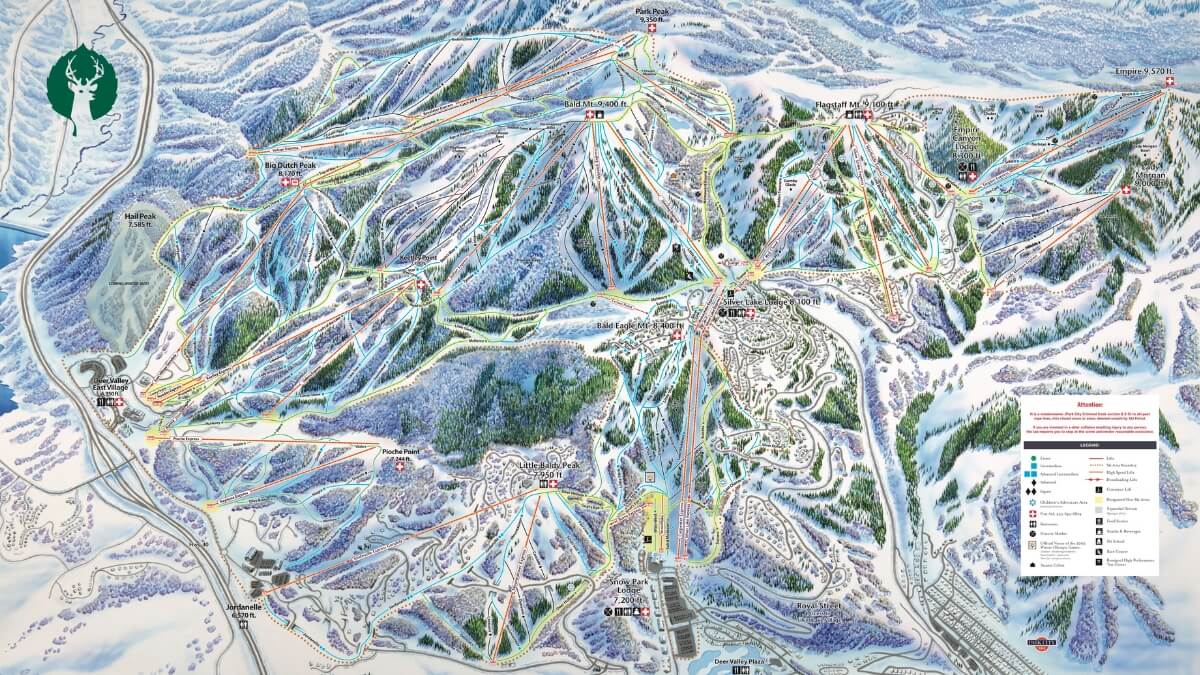
Deer Valley New Trail Map 25-26 Season Photo: Deer Valley Resort
Seven chairlifts and nearly 80 runs opening this winter mark the largest phase yet of the resort's multi-year project
PARK CITY, Utah — Deer Valley Resort’s freshly released trail map offers the clearest look yet at what skiers will actually access this winter as the resort’s multi-year expansion continues to unfold.
The 2025-26 map, released Friday, details seven additional chairlifts and nearly 80 runs opening in the coming months — the second and largest phase of terrain additions since the project began. Combined with last season’s openings, the resort now operates 10 new lifts and 100 new runs compared to two winters ago, pushing total acreage past 4,300.
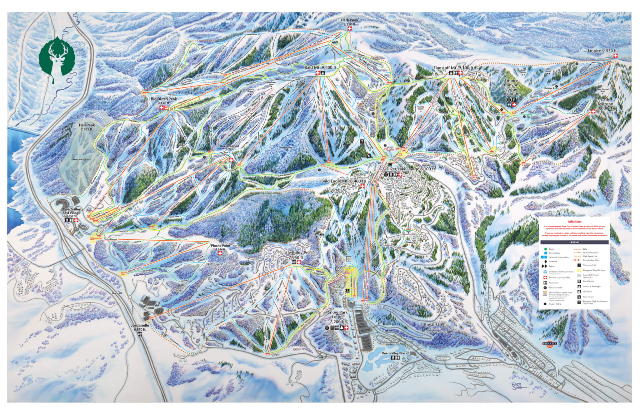
The headline addition is the East Village Express, a 10-passenger gondola connecting the base village to Park Peak. Once there, skiers can drop into terrain across four integrated peaks: Park Peak, Big Dutch Peak, Keetley Point and Pioche Point.
Among the new runs is the Green Monster, a 4.8-mile groomer descending from Park Peak’s summit to East Village — one of the longer continuous runs in the Wasatch and designed to give lower-intermediate skiers more vertical without the steeps.
The map itself, hand-painted by ski artist Rad Smith, shows the expanded geography in his trademark aerial style. His illustrations have become collectibles among ski enthusiasts, and this version captures how dramatically Deer Valley’s footprint has grown.
“This year’s map captures a significant moment in Deer Valley’s history,” said Susie English, the resort’s vice president of marketing. “With more lifts, more runs, and a greatly expanded footprint, it reflects how far we’ve come in realizing our vision to elevate the Deer Valley experience while still maintaining the character and care that define our resort.”
The expansion continues through at least 2026-27, when Hail Peak terrain is scheduled to open. South Peak development follows in later phases, though timelines remain fluid.
For now, the map provides the first complete picture of what this winter looks like — and a preview of how much larger Deer Valley will eventually become.
The trail map is available at deervalley.com.
By: Laura M

325 White Pine Canyon Road
Park City, UT 84060
3267 W Deer Hollow Road, Unit 2305
Park City, UT 84060
80 West 300 North
Salt Lake City, UT 84103
1511 S Valley View Circle
Springville, UT 84663
2349 S Lava Vista Drive, Lot 32
Santa Clara, UT 84765
438 Castle Valley Drive
Castle Valley, UT 84532Talk of the Town


Park City Jobs

Computer / Website Assistant, Summit Support
Today Part time $20.00 - $30.00 hourly

PROGRAM AND EVENT COORDINATOR, PC READS
1 day ago Part time $25.00 hourly
Development Manager, Blue Sky Utah
1 day ago Part time $28.00 - $32.00 hourly
Executive Assistant / Property Manager Administrator, Model HOA
1 day ago Full time $30.00 hourly