Weather
Incoming storm could drop 10 inches of snow in Park City’s mountains
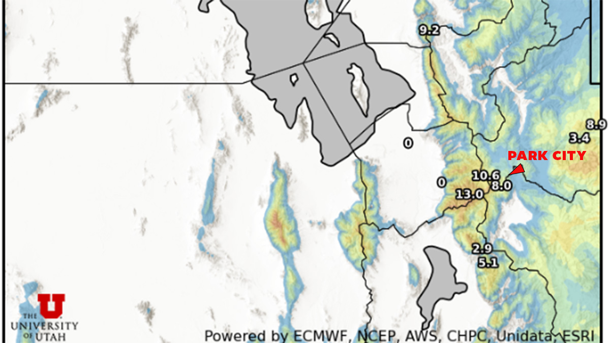
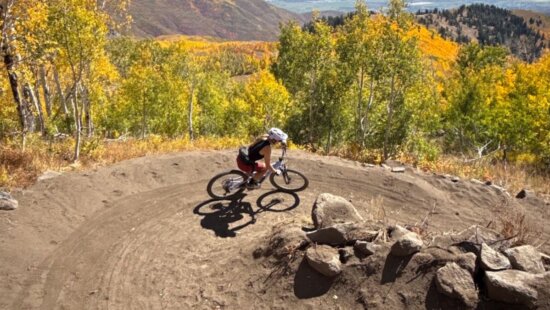
Photo: University of Utah
Up to six inches is in the forecast for the Wasatch back, while the upper Cottonwoods could see as much as 16 inches.
PARK CITY, Utah – A storm system and accompanying cold front will move into Utah this weekend bringing up to 10 inches of snow at high elevations locally. This bodes well for Utah’s water supply however it will put a damper on mountain bike conditions in Park City, especially up high in the mid-mountain neck of the woods.
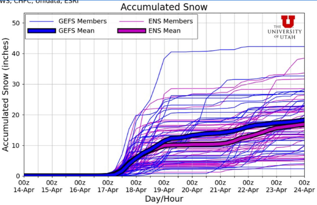
Open Snow calls for 1-2 inches of snow at 8,714 ft of elevation on Saturday night when temperatures will drop to a low of 34 degrees. Sunday morning up to 5 inches is in the forecast with more throughout the day. Sunday will be cold with temps in the low 30s and high 20s overnight. Snow showers could linger into Monday morning.
Up to 16 inches could fall in the Cottonwoods. The Utah Avalanche Center issued a warning Friday morning that a strong storm with potentially heavy snow and high winds is on the way.
“Avalanche danger will rise, especially in wind-loaded terrain. There’s no official forecast right now—so you’ll need to make your own calls. Stay sharp, travel safe, and always be avalanche aware,” a UAC post read.
Spring snowstorms in Utah can be especially tricky and hazardous for backcountry skiers navigating mountain terrain due to a mix of rapidly changing snow conditions, variable stability, and seasonal terrain hazards. Last year, on May 9, two skiers died in the Big Willow avalanche, which occurred a few days after a late spring storm brought nearly 2 feet of snow to the Wasatch.
By: Marina Knight

325 White Pine Canyon Road
Park City, UT 84060
2349 S Lava Vista Drive, Lot 32
Santa Clara, UT 84765
3267 W Deer Hollow Road, Unit 2305
Park City, UT 84060
438 Castle Valley Drive
Castle Valley, UT 84532
1511 S Valley View Circle
Springville, UT 84663
80 West 300 North
Salt Lake City, UT 84103Talk of the Town


Park City Jobs

Hiring Barista Assistants and Baristas, Silver King Coffee
1 day ago Part time $17.00 - $30.00 hourly
General Maintenance Technician, Moose Management Vacation Rentals
5 days ago Full time

Office Coordinator, Park City Community Foundation
8 days ago Full time $50,000 - $55,000 yearly

Summit Land Conservancy Programs Specialist, Summit Land Conservancy
8 days ago Full time
Vice President of Finance, Park City Community Foundation
8 days ago Full time $115,000 - $130,000 yearly