Weather
Winter returns as Wasatch could receive 1 to 2 feet of snow by Tuesday
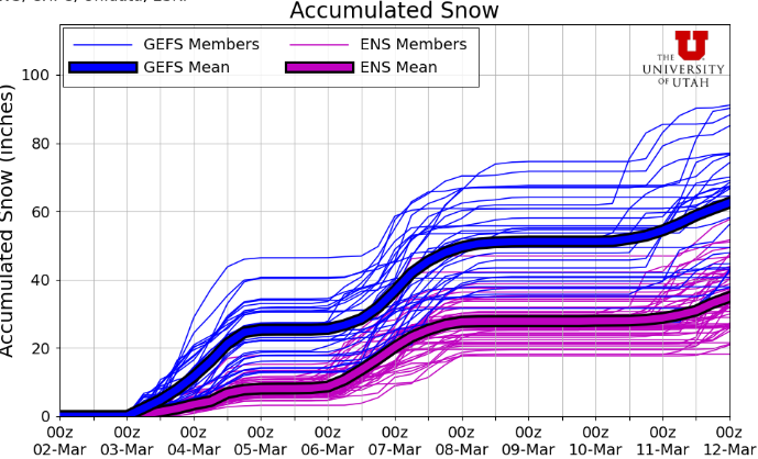
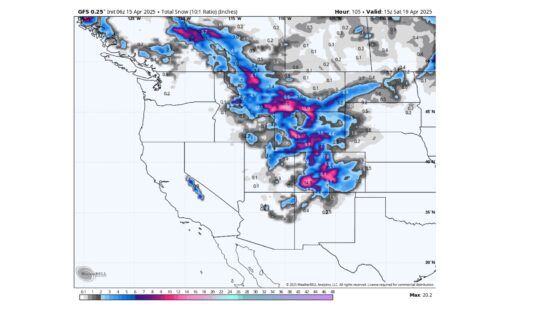
Photo: Utah Snow Ensemble model total snowfall // UofU Dept. of Atmos. Sciences
Two winter storm systems set to impact Park City this week
PARK CITY, Utah—After a 10-day drought without precipitation, snow will return to Utah late Sunday night and into Tuesday morning. Breezy conditions and unusually warm temperatures on Sunday will give way to some light precipitation beginning in the late evening, with much colder air eventually moving in overnight.
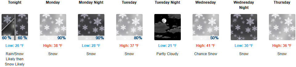
The main part of the storm system looks to dig to our south, with somewhat light winds eventually shifting to the northwest Monday afternoon through Tuesday morning as the low-pressure center moves in. The second part of the storm, which will focus on the Cottonwood Canyons on Monday evening, will have the greatest chance for accumulations on the higher end of the expected snowfall range. Park City could see 2-5 inches of snow by Tuesday morning.
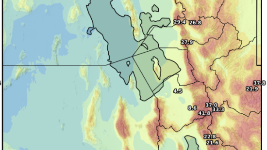
Forecast snowfall totals through Tuesday
- Cottonwood Canyons: 12 – 20”
- Park City / Deer Valley: 6 – 12”
Long-range outlook – more snow expected Thursday through Friday
After a brief lull in activity Tuesday afternoon into Wednesday, another winter storm is already knocking on Utah’s door. This similar tracking system (to our south) should bring an additional 1-2 feet of snow for the Wasatch beginning early Thursday through Friday afternoon.
Snowpack update
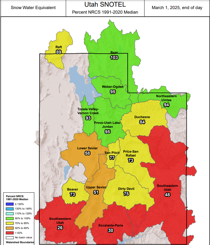
With meteorological winter now in the rear view as of March 1, even with the recent lull in storm activity, the northern Utah snowpack is still doing quite well, with most basins around the Wasatch reporting near normal averages. Alta typically averages 97 and 77 inches in March and April, respectively, so we still have a lot of time to keep adding to the snowpack. Total snow water equivalent (SWE) at upper elevation sites typically peaks in late April, whereas lower elevation and stations farther south peak at the beginning of April.
By: Adam Lenkowski

2349 S Lava Vista Drive, Lot 32
Santa Clara, UT 84765
438 Castle Valley Drive
Castle Valley, UT 84532
80 West 300 North
Salt Lake City, UT 84103
3267 W Deer Hollow Road, Unit 2305
Park City, UT 84060Talk of the Town


Park City Jobs

Junior Interior Designer, Abigail Hill
4 days ago Contractor

Dental Assistant, Rise Dental Wellness
4 days ago Full time

Sales & Marketing Coordinator – B2B Publishing, Power Trade Media
6 days ago Full time $40,000 - $45,000 yearly

Garden Steward and Educator, Summit Community Gardens and EATS
11 days ago Seasonal
PROGRAM AND EVENT COORDINATOR, PC READS
12 days ago Part time $25.00 hourly