Weather
Powder alert: Utah resorts eye 32-inch storm total
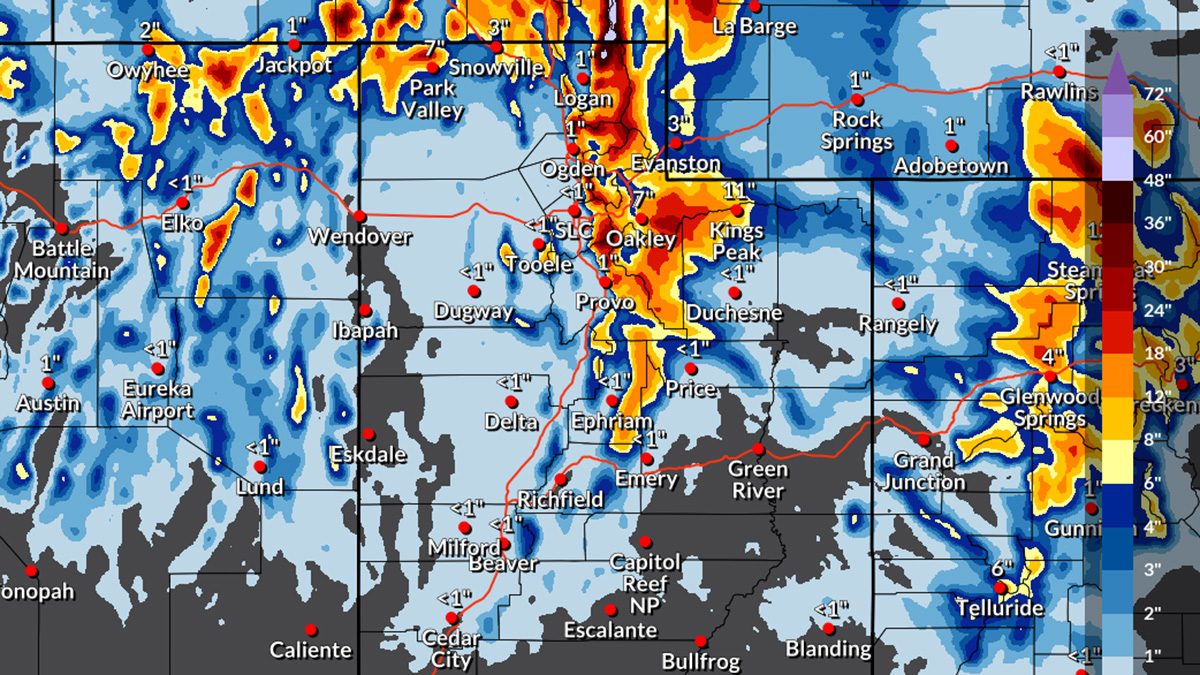
Incoming storms will bring much needed snow to Utah beginning Dec. 26-29. Photo: NOAA
As storms come in avalanche danger will rise in the next 24-48 hours
PARK CITY, Utah – Utah’s ski season is about to see a significant boost as the first substantial storm cycle of 2024-25 sweeps through the region, promising improved conditions for Northern and Central Utah resorts. Back-to-back storms are expected to deliver heavy snowfall Thursday through Friday, with a brief lull over the weekend and the possibility of more snow Sunday night into Monday.
Here’s how things are shaping up between Thursday, Dec. 26 and Sunday, Dec. 29.
Thursday & Friday
Following a modest 1-4″ from the Christmas Day storm, conditions at nearby ski areas are beginning to look up. A series of three snow events will continue to enhance the snowpack through the week:
- A quick burst of light snow will move across Utah Thursday morning, dropping 1-2″ of fresh powder at ski areas. Snowfall is expected down to valley floors.
- Late Thursday afternoon into the evening, a moist northwest flow will bring heavier snow, especially to the Cottonwood Canyons. This wave is expected to accumulate more efficiently, with snow levels again reaching valley floors.
- The most promising snowfall arrives Friday between 8 AM and 10 PM. A strong northwest flow at the tail end of this system could significantly boost totals, especially for resorts in the Cottonwoods.
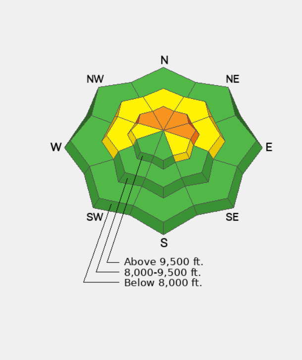
Caution: Strong winds Friday evening could create ridgeline gusts of 50-70 MPH, contributing to rapidly worsening avalanche conditions. Skiers and snowboarders should monitor the avalanche forecast closely.
The Utah Avalanche Center calls for moderate danger today, rising to considerable across upper elevation slopes facing north, northeast, east and northwest in the next 24-48 hours.
It will become likely to trigger an avalanche 1-3 feet deep, failing on a persistent weak layer of faceted snow.
Storm Total Snowfall Predictions by Sunday Morning
By Sunday morning, Utah’s ski resorts are expected to see substantial accumulations:
- Little Cottonwood Canyon – Alta, Snowbird: 12-32″
- Big Cottonwood Canyon – Brighton, Solitude: 13-30″
- Snowbasin, Powder Mountain: 9-21″
- Park City – 8-18″ Deer Valley: 10-21″
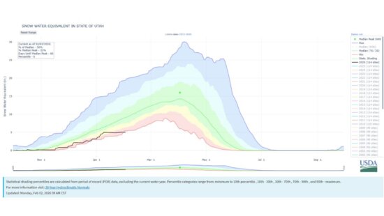
This storm cycle marks a turning point in Utah’s dry weather pattern and will help aid perilously low snowpack. Let it snow!
View this post on Instagram


