Snow
More snow on the way: 1-2 feet expected in Utah as atmospheric river moisture arrives
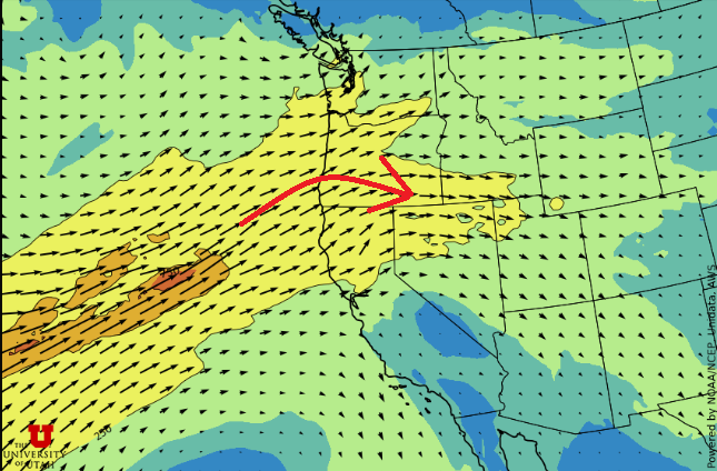
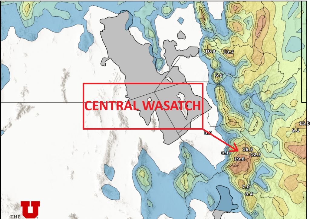
Photo: Forecast map of moisture transport // UofU Dept. of Atmospheric Sciences
Temperatures and snow levels will rise today, before a lull in activity overnight into Sunday when a strong cold front and additional snowfall arrives Sunday evening
PARK CITY, Utah – The first phase of the multi-day winter storm, which began Thursday morning and brought 14–25 inches of snow to the Wasatch, is now behind us. However, snowfall is picking up again this morning and will continue through midnight as we enter the first of two new storm periods.
A warm, very moist atmospheric river is moving into Utah currently, which will raise snow levels to around 7500 feet by this afternoon. Ski resort base areas in Park City and Deer Valley could see a rain-snow mix, and possibly mostly rain.
Snow totals today are expected to be 7-14” of wet, dense snow. Snowfall will quickly taper off around midnight tonight as the strong southwesterly winds help keep the moisture to our north.

Warm temperatures and gusty winds will remain in place through Sunday evening, when a strong cold front is expected to arrive Sunday night into early Monday morning. This final piece of the storm cycle should produce another 6-12” of snow for the Central Wasatch, with significantly lighter snow density as much colder air arrives.
Snowfall is expected to taper off by early Monday afternoon but could linger for the Cottonwood Canyons as cold northwest flow persists. Overnight temperatures for Park City could dip near the single digits Tuesday morning as the storm clears.
Current snow totals, Thursday morning through 8am Saturday
- Park City / Deer Valley: 14-18” of snow
- Brighton / Solitude (BCC): 18-22” of snow
- Alta (LCC): 25” of snow, 2.38” of liquid water content
Winter storm and avalanche warnings
The National Weather Service in Salt Lake City has issued a winter storm warning for the Wasatch Mountains that lasts through 11:00pm Saturday Night. The Utah Avalanche Center has issued an avalanche warning through 6am Sunday morning. “Heavy snow combined with strong wind is creating widespread areas of unstable snow. Both human-triggered and natural avalanches are likely”, says the UAC website. There was a report of a large natural avalanche along the Park City ridgeline on Friday.


