Snow
Chance of snow tonight as storm grazes northern Utah

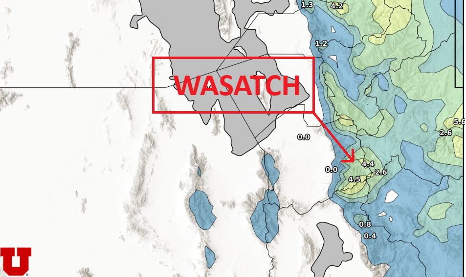
Photo: HRRR Model Total Snow Through Tuesday Evening // UofU Dept. of Atmos. Science
One more small storm system will impact the Wasatch tonight before mild, calm weather returns
PARK CITY, Utah – Slight high pressure and warm air moving in today will keep temperatures right around 40, before a storm to our north passes by overnight. The Central Wasatch could receive 1-3” of snow, however we are on the very southern edge of the moisture yet again. A weak cold front and winds shifting to the west/northwest Tuesday morning will cool temps down a few degrees, but high pressure quickly builds back in Wednesday with rising temperatures into the 40s.

Possible poor air quality for northern valleys will begin to develop Friday and Saturday, before a low-pressure system potentially grazes Utah.
Recent storm totals
The Wasatch mountains have received snowfall the last 3 days in a row, starting with the Friday morning storm on 12/13, through Sunday 12/15. A foot of snow fell at Alta Friday morning, while Park City area mountains received about 3-5”. On Saturday, warm, southwest winds brought a uniform coat of snow with an additional 3” to the Central Wasatch. Finally, the storm on Sunday morning arrived with lower-than-expected totals across the Wasatch with about 1-3” reported. The northern mountain ranges were the winners of the Sunday storm, with Ogden area mountains reporting 6” and about 10” in the Logan/Bear River mountains. Tonight’s storm will yet again favor these far northern mountain locations.
View this post on Instagram
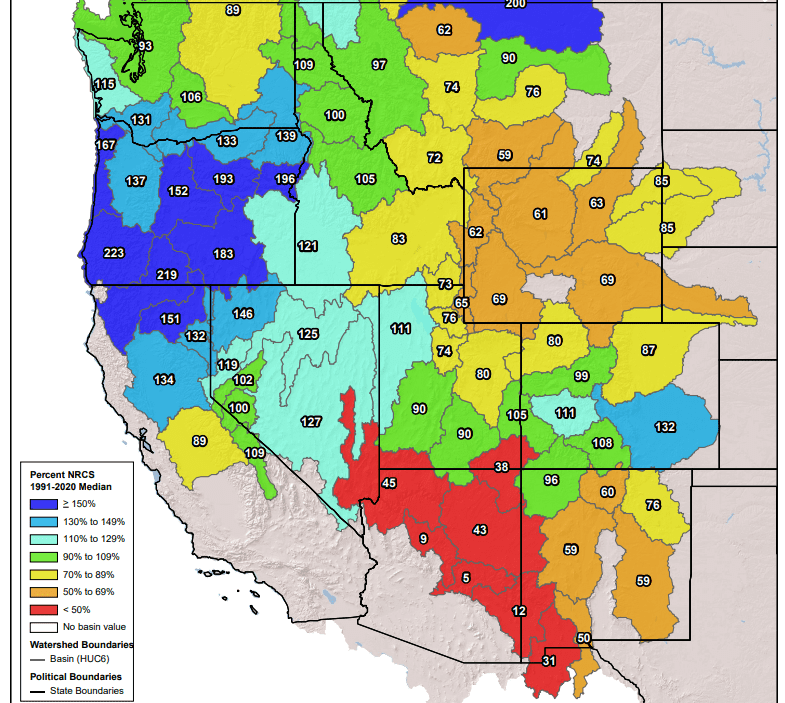
Western snowpack
As we now enter mid-December, snowpack totals are starting to take shape across the west. While the early season storms favored the southwest U.S. in areas like southern Colorado, the storm track has shifted in recent weeks. Atmospheric rivers, and the double bomb cyclone storms had significant impact on the pacific northwest, while more recent storms have had a bullseye on northern California and Oregon.

The backcountry snowpack avalanche danger ratings now range from low to considerable based on aspect and elevation according to the Utah Avalanche Center. “We now have two buried weak layers in our immature snowpack.”
The next chance for snow to return looks to be sometime near the end of this weekend. However, much uncertainty still exists in this long-range outlook.


